
Itinerary
Day 1: Kathmandu to Lukla (Flight). Trek to Jorshalle (2800m), 6 and half hours of walk, stayed at Hotel Tibet Lodge and restaurant (good package for Nepalese and Nepali food lovers)
Day 2: Jorshalle to Namche trek (3,440 m), 3 to 4 hours of walk, stayed at my new friend’s place whom I met at the Kathmandu airport, visited the Pasang Lhamu View point and Everest View Point hotel-3880m (it was good for acclimatization), it was foggy, so no view from the Everest view point hotel
Day 3: I felt fine, so no extra day for acclimatization, I headed to Pangboche 4000m via Tengboche 3860m, 7 hours(slow walk on steep trail), started at SharKhmbu hotel (such nice hosts! And beautiful interior), still foggy, so didn’t catch any view

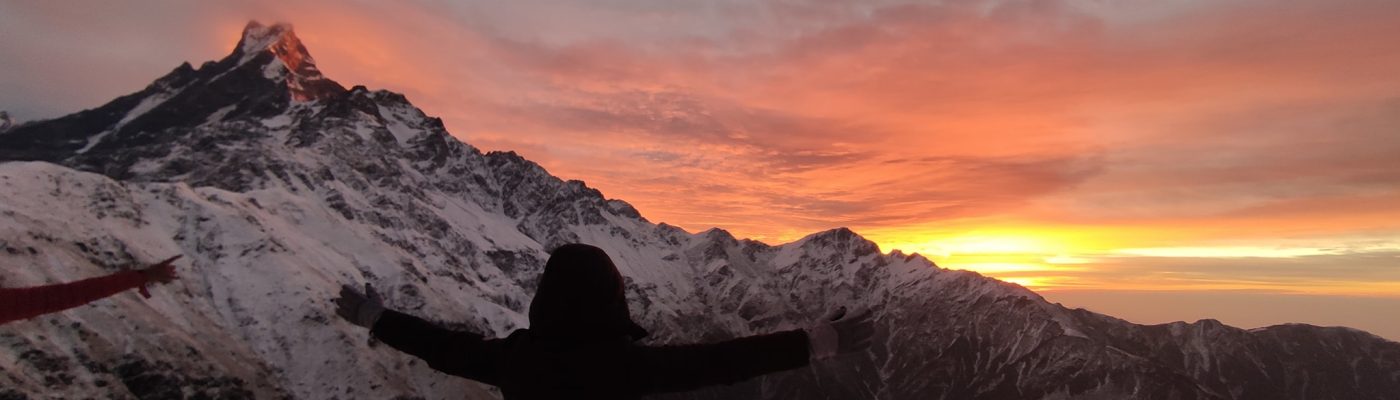
Day 4: Beautiful sunrise view of Amadablam lured me to go the the base camp, Pangboche to Amadablam Basecamp 4680m, 3 to 4 hours, back to Pangboche and headed to Dingboche 4410m, stayed at Yak Lodge(fancy hotel and yet not very pricy), what a luck! Amazing Amadablam Sunrise view and at the basecamp, I spent around 3 hours enjoying being surrounded by the Himalayas
Day 5: Morning hike to Nagarjuna View Point 5083m and back to Dingboche (3 to 4 hours), Dingboche to Thukla 4620m (2 to 3 hours), stayed at Kalapatthar Lodge (it was decent and only two hotels in Thukla so not a lot of options), Makalu, Thamsherku, Amadablam, Tapuche and Lobuche view, most beautiful view for me was the view of Makalu (As I had been to Makalu Basecamp before)
Day 6: Thukla to Lobuche 4920m, 2 to 3 hours, hike around to see the Lobuche view and Khmbu Glacier (slow day was big help for acclimatization), stayed at Oxygen Altitude Restaurant and Lodge (pretty chic and clean hotel, i loved everything about it), Khumbu glacier looked magnificent
Day 7: Lobuche to Gorak Shep 5,140 m to Everest Base Camp 5,364 m and back to Gorakhshep and

hike to Kalapatthar 5550m for Sunset view and back to Gorakhshep (extremely long day but so worth it), stayed at Buddha Lodge (rooms are just ok, I didn’t like it much, food was good. Only place where i couldn’t sleep well, may be because of altitude as well), obviously the view of Mt. Everest was better from Kalapatthar and what a right decision to go there for sunset view
Day 8: Gorakshep to Dzongla 4830m via Lobuche (towards Gokyo lake), around 3 hours, easy trail, stayed at Maison Sherpa (the most beautiful and clean hotel I ever stayed in that trail and I had such a good sleep), Tapuche mountain is just on the side when you walk on this trail

Day 9: Dzongla to Chola Pass 5420m (around 4 to 5 hours, what a beautiful experience with adventure and amazing view) and to Thangnak or Dragnak 4700m (around 3 hours), stayed at Hotel Khumbila (I might have confused the name, nice and clean hotel, good food), almost 360 view of the mountains from Chola pass

Day 10: Dragnak to Gokyo 4750 m(3 hours via glacier trail-scary and be careful of falling rocks, walk with guides or groups if possible as this trail can be confusing) and hike to Gokyo Ri 5357m and hike back to Gokyo (4 hours), beautiful view of Mt. Everest (better than Kalapatthar), Lhotse, Cho Oyu and Makalu (all above 8000m Himalayas), stayed at Himalayan Eco Resort, right in front of Gokyo Lake and room with Lake view

Day 11: Hike to Renjola pass 5460m(4 to 5 hours, very steep), and hike downhill to Marlung 4200m (downhill, 5 to 6 hours), stayed at Riverside Hotel and Lodge, the village is almost empty and only this hotel was in operation, the most amazing view of Mt. Everest, Makalu, Lhotse and Cho Oyu and Gokyo Lake from Renjola pass
Day 12: Marlung to Namche (10 hours)
Day 13: Namche to Surke 2480 m (old EBC trek route), beautiful villages on the way, lot of mules walking in the trail, so expect the smell of mule dong
Day 14: Surke to Jubin 1700m (10 hours), expect to encounter with Mule traffic

Day 15: Jubin to Junbeshi 2700m ( you are taking the trail to 1500m and climb 3500m elevation and again go to 2700m, 8 to 9 hours), Thaksindo, Nunthala, Ringmu village, beautiful villages on the way, very clean trail and old hotels (no more tourists), Ringmu village was my favourite

Day 16: Junbeshi to Kinja 1646m Via Lamjura Pass 3500m, 9 to 10 hours, expect the drastic change of weather in these places, very beautiful trail again, old villages and tea horses and hotels-mostly abandoned but you can find places to eat
Day 17: Kinja to Shivalaya 1800m via Bamti

Bhandar 2990m and Deurali 2700m, 7 to 8 hours, scenic view of the villages, Bamti Bhandar bazaar is beautiful, Deurali to Shivalaya trail is forgotten trail, most of the houses and old shops are abandoned and you will see almost no one on the trail except closer to Shivalaya. Also, as per local there is frequent bear attack on this trail and I was so scared at times as I was walking alone. From Shivalaya, I took a lift on a Truck to Jiri (Shivalaya to Jiri trail is forgotten as well) and another lift on a Truck again to Tamakoshi
Day 18: Tamakoshi to Charikot and all 🙂
Gears I used
2 pairs of trousers (one set thin and one set thick windproof trousers), one yoga pants (used it as inner layer when walking), one set of warmers (used it as sleeping wear), 3 Tshirts(gym wear), a warm hat, a monkey fleece hat and a cap, a pair of sunglasses with strings (retainer), water proof jacket(best combo to wear it as windproof while walking), a down jacket, a fleesh jacket (do wonders to wear it as second layer in extreme cold weather), two pairs of gloves (thin one to use it when walking and thick one for cold places), a small tumbler, a water pouch, small hot water bag, 2 power banks (they would charge you for mobile charging, so better to have power banks), knee guard (so helpful), a set of crampons (used it only at Cholapass), head torch, a knife (only used it to cut the apples and beetroots hahha..) and a packet of beautiful thousand smiles (so important to get information and meet fellow travelers). For next trek, I would add an emergency sleeping bag just in case

I just got curious by your information on Deurali to Shivalaya trail, where the village houses and trail shops are abandoned due to out migration with increased in the existence of wildlife with frequent attack by bears.
I will try to write about it soon.
Whoa I’m jealous Nilima ~ 18 days of pure bless and nature. Can’t believe you went solo all the way. I was shit scared when I saw a bear in my ABC trek near the hotel’s garden trying to eat steal veggies. Also, those abandoned hotels conspire eerie feelings.
Would love to see more photos. Also, can you mention your total expenditure for a rough estimate for a budget if someday a bluebird takes me to Gokyo 🙂
Hey! From Bamti to Shibalaya, there is this part where I walked through jungle and abandoned houses. The grass were taller than me and I kept on walking making random noises as I was scared. Later when I reached Shibalaya, people told me that there are bears on that route. And it has only been 3 days that a man was attached by a bear on the very place. haha… The truck driver, who I ask for a lift later, asked me many times to confirm if I really walked through that route alone.
And you won’t believe that EBC was my least spent trek. The flight ticket was Rs. 8,000 and the total other expenses were Rs. 15,000 only. In most of the hotels, they didn’t charge for my bed and got discount prices for food in most of the places. I guess, people were just nice and kind as I was walking solo.
If you go to Gokyo, the best view of Everest is from the top of the Renjola pass. I hope you go there soon.